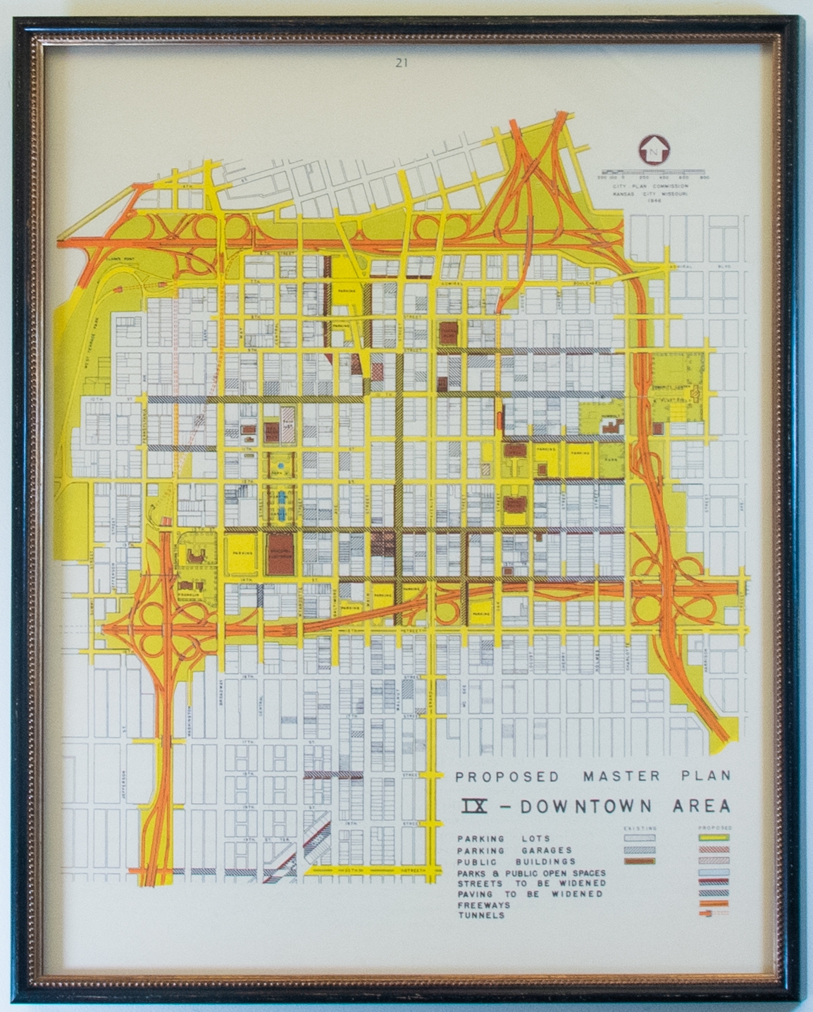
1946 City Plan Commission Map of Downtown Area

Inventory
Collection Number: 
17260
Building: 
Current Location: 
Elevator Area
Floor: 
5th
Object Description
Object Type: 
Details: 
This is a reproduction print of a Kansas City Planning Commission map of the downtown area in 1946.
Framed: 
Yes
 - Plexi
Length: 
10 1/8 inches
Width: 
1 1/4 inches
Height: 
27 5/8 inches
Description: 

This map lays out the ninth Proposed Master Plan of the Downtown Area and was generated in 1946. The plan's primary feature is the expressway loop surrounding the gridded area. Existing and proposed parking arrangements, public spaces, street improvements, freeways, and tunnels are indicated in the legend with corresponding color and pattern on the map.

Reproduce the Work in Library publications/publicity, including film or videotape: 
No
Make slides or videotapes for educational use: 
No
Permit the general public to photograph the work : 
No