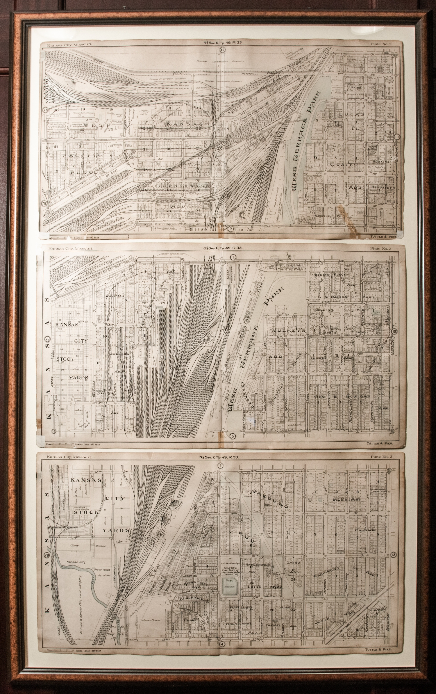
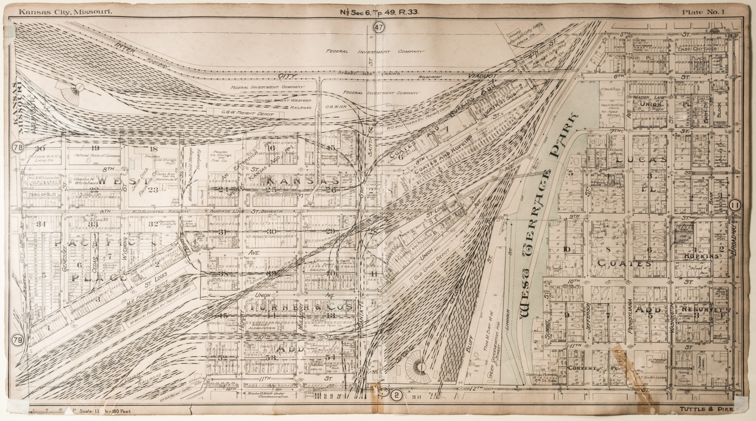
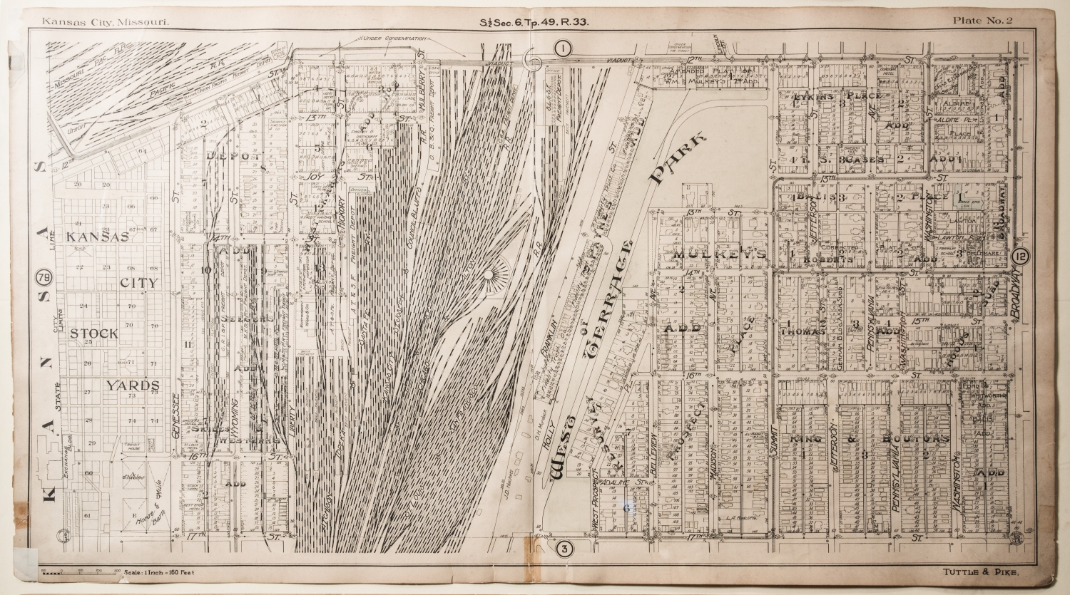
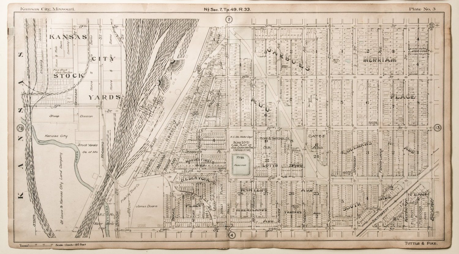
Map of Kansas City Stockyards
The Kansas City Stockyards operated in the West Bottoms of Kansas City from 1871 to 1991. It was the second largest stockyards in the nation and one of Kansas City’s most important industries. Three separate maps comprise a whole view of the stockyards. Reading from top to bottom, each map is numbered Plate One, Plate Two and Plate Three. The maps were created circa 1907, from map makers Tuttle and Pike. Plate One details "N 1/2 Sec. 6, Tp. 49, R 33.". Two of the neighborhoods included in this area are Coates and Hopkins Addition. Plate Two details "S 1/2 Sec. 6, Tp. 49, R 33." Two of the neighborhoods included in this area are Prospect Place and Thomas Addition. Plate Three details "N 1/2 Sec. 7, Tp. 49, R 33." Two of the neighborhoods included in this area South Side Place and Jarboe's Addition. The collection of the three maps together creates a unique historic view of the iconic Kansas City Stockyards, the West Terrace Park and surrounding neighborhood.