We are upgrading our public computers and due to time needed for installation of planned enhancements, public computers at each location will be unavailable or limited for patron use on certain dates.
Plaza Map
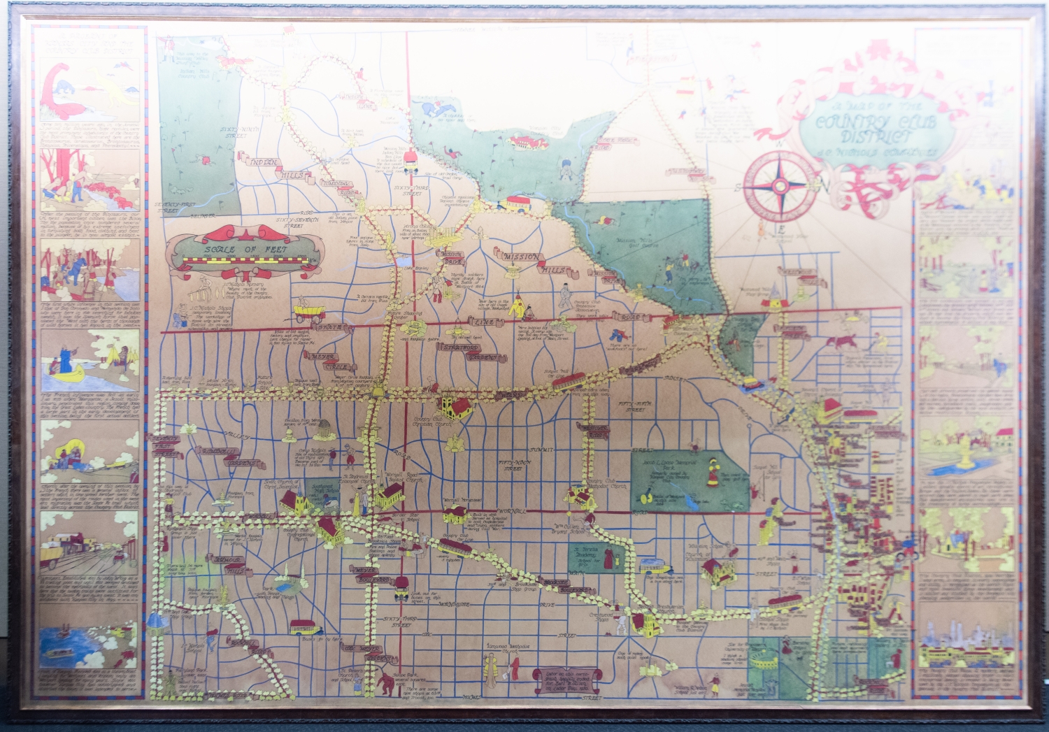
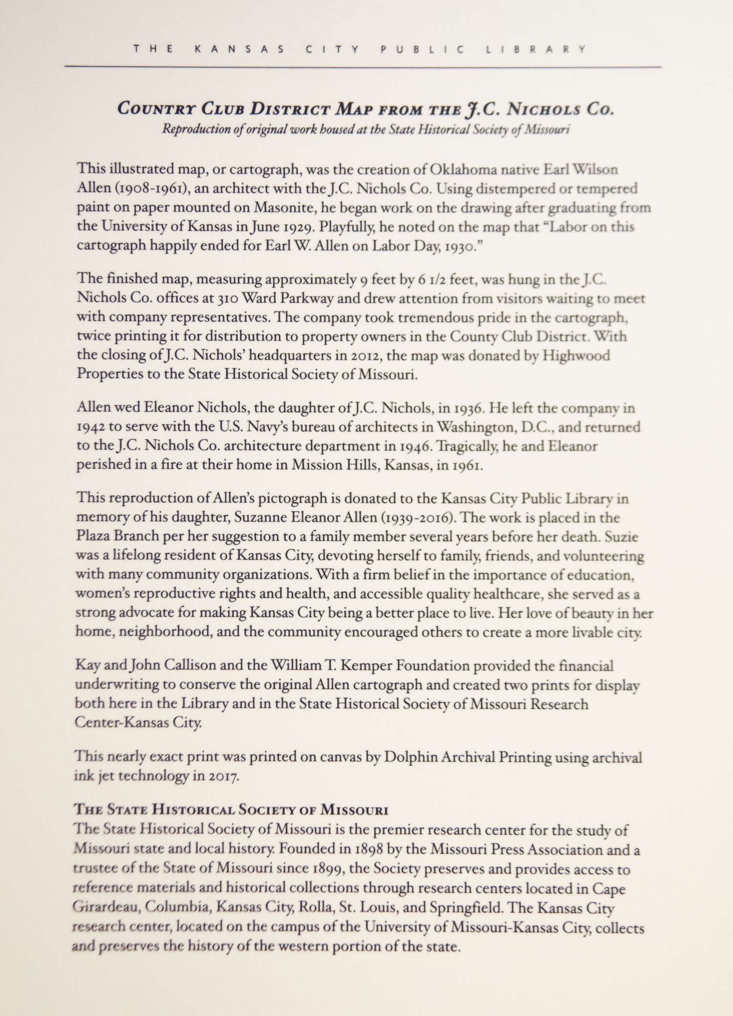
This print is a nearly exact reproduction of a map of Kansas City's Country Club district produced in 1930 by Oklahoma native Earl Wilson Allen. It was printed on canvas by Dolphin Archival Printing using ink jet technology in 2017. Allen served as an architect with the J.C. Nichols Company. Allen utilized tempered paint on paper subsequently mounted on masonite. With the closing of J.C. Nichols headquarters in 2012, this reproduction of Allen's pictograph was donated by Highwood Properties to the State Historical Society of Missouri. It was then donated to the Kansas City Public Library in memory of his daughter Suzanne Eleanor Allen.
It should be noted that Allen's pictograph is problematic in that it depicts outdated connotations of the white settler. While outdated and questionable, the map does allow for discussion regarding the systemic and structural nature of racism.