Services, including logging in to resources, will be temporarily down for maintenance the evening of Friday, October 17.
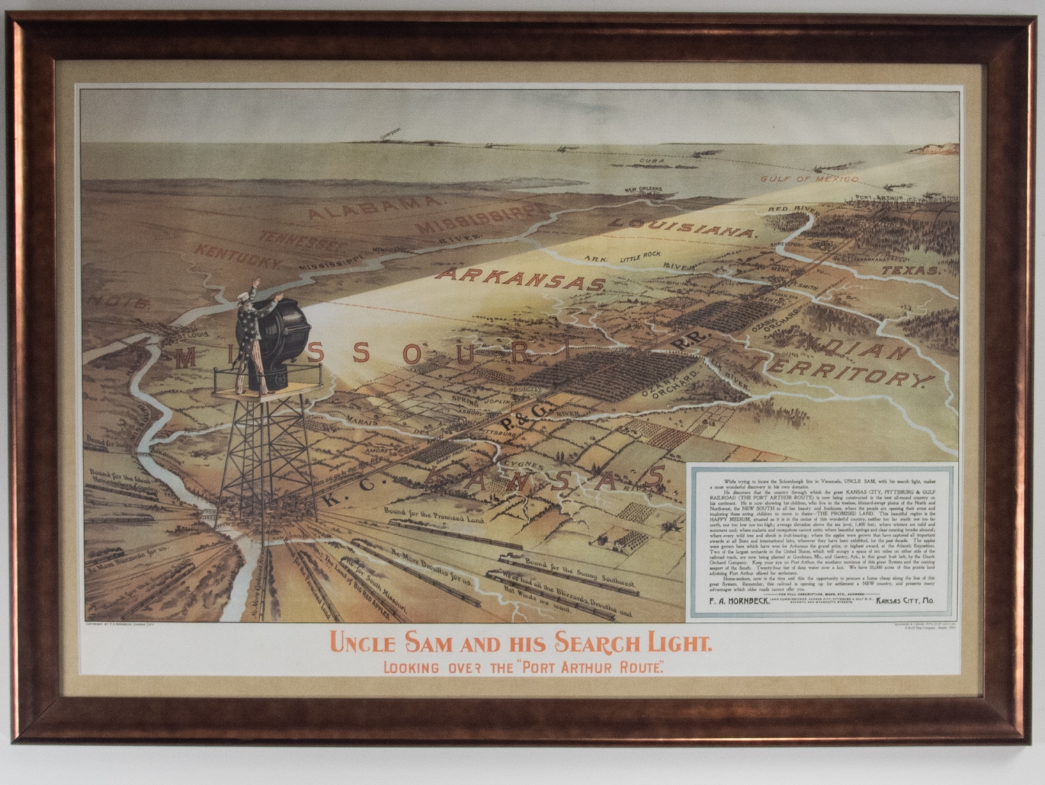
Uncle Sam and His Search Light: Looking Over the "Port Arthur Route"
In this map, Uncle Sam stands atop a platform shining his searchlight onto the Kansas City, Pittsburg, and Gulf Railroad referred to in shorthand here as "The Port Arthur Route." A didactic in the lower right hand corner explains that while Uncle Sam was looking for the Schomburgk Line like in Venezuela, he discovered the (literal) fruits of his own domain, namely the "The Promised Land" region of North America between the blizzards of the north and the swampy heat of the south. This land is reportedly mild, pleasant, and fertile with world-class apple orchards shown lining the railway route. Accordingly, the didactic calls on the American people to populate this land and to remember that it will be the Port Arthur Route that will make it possible. The map acts as a kind of advertisement for the route, the land it covers, and the overall expansion of the New World.